Applied Digital Skills – Guide to an Area: World War 1 Lesson Notes

I love maps. There are tons of great mapping resources out there: Google Earth, Maps, and Streetview to name a few. Google MyMaps is another one that allows us to annotate pretty significantly.
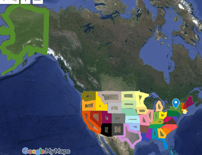
 When I first rolled out MyMaps to my middle school social studies classes, one student went home and immediately traced out the 50 states!
Wow, I wish I had that kind of time and energy!
MyMaps has been well received as a useful tool in my social studies classroom for increasing our understanding of geographic factors on historical events. As you have probably gathered, I could go on and on about MyMaps… but this post focuses on using these awesome Geo tools in a little different way supported by Google’s Applied Digital Skills program.
This school year I have been using Google’s Applied Digital Skills program to teach my Social Studies students. I began with the If-Then Adventure Story Lesson and remixed it with a geeky-process of creating our own app about the Ellis Island Immigration Process. Next, I taught students about researching with trusted content by using the Research and Develop a Topic Lesson.
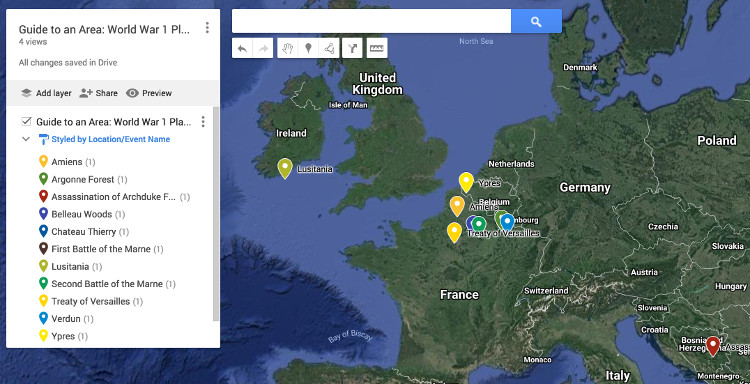
When my classes studied World War 1, I used the Guide to an Area Lesson to pre-teach the content. Rather than guide a random area of interest, this lesson was remixed to support research and a geographic understanding of Places and Events that were significant to our study of World War 1. We used Lesson 1 and Lesson 4 to gather data in a spreadsheet (Lesson 1) and import the data into a Google MyMap (Lesson 4). Lesson 2 and 3 are great but time was an issue and I needed to modify the accordingly.
Here are the particular steps I gave my students to adopt the Applied Digital Skills Lesson as a relevant resource in my classroom.
Tech & Learning Newsletter
Tools and ideas to transform education. Sign up below.
To begin have students…
- Go to the Applied Digital Skills website.
- Log in
- Select “I am a Student”
- Enter this course code: __________
- Begin the “Guide to an Area Lesson”
Lesson 1
Students completed Videos 1 and 2 and when they got to video 3 they modified their spreadsheet using my notes.
Video 3 NOTES
- TITLE your Spreadsheet: “Guide to an Area: World War 1 Places and Events”
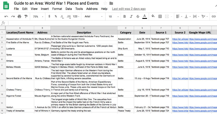
- Column Headings: Location/Event Name, Address, Description, Category, Date, Source 1, Source 2, Google Maps URL
- YOU NEED to identify information for the locations/events provided in class, with a MINIMUM OF ONE EVENT PER YEAR FROM 1914-1919. Use your Prentice Hall: America History of Our Nation (textbook) pages 706-711, the map on page 719, and page 724. For example, page 707 starts with the “Assassination of Archduke Franz Ferdinand.”
- Continue to find detail about each location through a Google Search. Keep track of your sources in the Sources columns. Every event must have two sources.
- Continue to Lesson 4 in Applied Digital Skills.
Completed steps for Video 3 look something like this:

I had to have conversations with my students about spreadsheet cells and how text is “hidden” when not wrapped. Students then followed the steps in Lesson 4 about how to “Make a Custom Map” which explained the process of importing the spreadsheet into Google MyMaps.

cross posted at micahshippee.com
Micah Shippee, PhD is an out-of-the-box-doer, a social studies teacher, and a technology trainer. He works to bridge the gap between research and practice in the educational sector. Micah explores ways to improve motivation in the classroom and seeks to leverage emergent technology to achieve educational goals. As an innovative "ideas" person, Micah likes to think, and act, outside the box. Micah is motivated and energetic, taking a creative approach towards achieving goals. As an Educational Consultant, and Keynote Speaker, he focuses on the adoption of emergent technology through the development of an innovative learning culture. Micah believe that innovativeness is the pedagogy of the future.
